From LEWISHAM to:
GREENWICH, DEPTFORD, NEW CROSS, CANADA WATER-ROTHERHITHE, NUNHEAD, PECKHAM


To Greenwich, along Coldbath St., Ditch Alley, Egerton Drive

To Deptford, along the Waterway Link

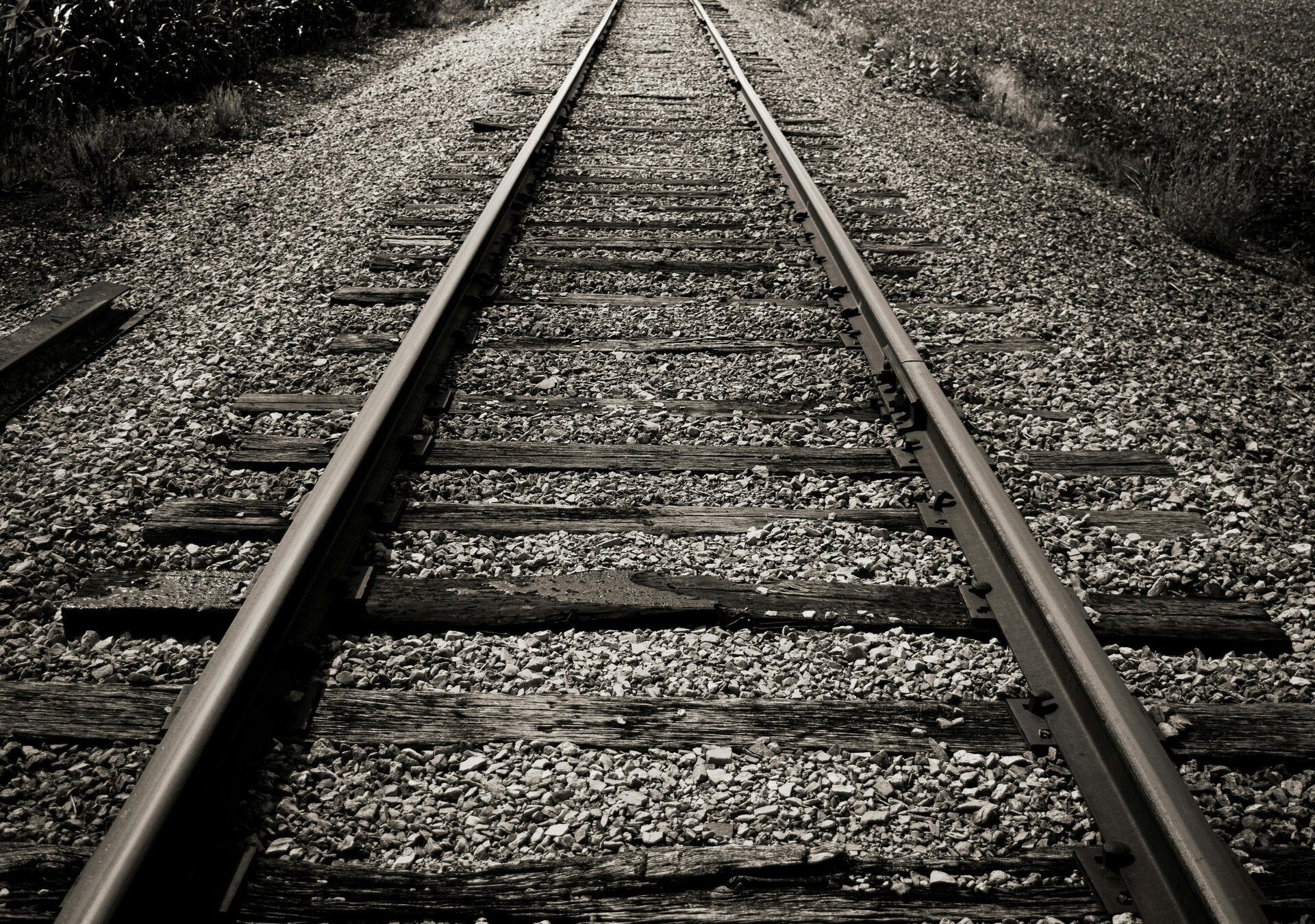
The Waterlink Way
Waterlink Way is a cyclepath and walking route in South East London. It extends from South Norwood Country Park (near Elmers End station) to the Cutty Sark ship in Greenwich, a total of eight miles.[1][2]
The Waterlink Way connects a number of parks and green spaces in South East London – including Ladywell Fields and Brookmill Park – while following the Pool and Ravensbourne rivers.[3] The route was designed to be accessible, with a large number of railway stations including Kent House, Lower Sydenham, Ladywell, Lewisham and Greenwich en route.[4]
Elverson Road DLR station
Opening in 1999 as part of the Lewisham extension, Elverson road station is one of the newer stations of the DLR network situated between Lewisham and Deptford Bridge.
To Deptford or Greenwich or on to Nunhead and Peckham
DEPTFORD WATER WORKS
The oldest surviving industrial installation in Deptford. The Ravensbourne Water Company was founded here in 1701; water was taken direct from the Ravensbourne. It became Kent Waterworks in 1809; three wells - known as Coldbath, Garden, and The Twins - were sunk about 30 metres into the chalk between 1849 and 1876, and water was not taken from the river after 1862. The Metropolitan Water Board took over in 1903, and sunk a new main well 40 metres deep in 1930, connected by adits or underground passages to the older wells. All these wells are still in use, and supply water to a large area of South East London. The capped tops of the Coldbath and Garden wells are visible. They had Boulton and Watt engines of 1811. They had 8 pumping engines of 858 hp. three engines for lifting water from the wells. In 1921 they were removed and some are at Kempton Park. Scrapped. The site is now bisected by the Docklands Light Railway.
GREENWICH PUMPING STATION
Greenwich Pumping Station, known until c. 1986 as Deptford Pumping Station,[1] is a sewagepumping station in the London Borough of Greenwich built in 1865 to the east of Deptford Creek. It is part of the London sewerage systemdevised by Sir Joseph Bazalgette in the mid 19th century.
After an outbreak of cholera in 1853 and "The Big Stink" of 1858, central London's sewerage system was designed by Joseph Bazalgette to intercept sewage flows and prevent them flowing into the Thames.
Over 150 years later, in the early 2020s, the Greenwich pumping station site was the location of a shaft used to drive the Greenwich connection tunnel to Chambers Wharf on the Thames Tideway Scheme, currently under construction,[11][12] and intended to partly supersede Bazalgette's system.
To Deptford, along ALBYN ROAD and TANNERS HILL. Or to New Cross and Canada Water, Rotherhithe
DEPTFORD NEW TOWN
Conservation Area


Tanners Hill
DEPTFORD OLDEST BUILDINGS
Nos.19 to 25 Tanners Hill were rebuilt in the 1750s on the site of even smaller 17th century cottages.
Some of the varied timber used in their construction probably came, legally or illegally, from the Royal Dockyard.
Early occupiers included shipwrights, market gardeners, and carpenters. Some of the houses were used for trades from the beginning, but the formal conversion of the ground floors began in the 1830s.
The terrace originally ran from 1 to 31, but 21 to 31 are the only 18th century survivors.


The S end of Deptford High St. is just across the main road
To Deptford along BROOKMILL PARK

BROOKMILL NATURE RESERVE
Brookmill Road Local Nature Reserve is a small nature reserve in St Johns in the London Borough of Lewisham. It has been designated as a local nature reserve.[1][2]
The reserve is on a disused railway embankment between Brookmill Road and the Lewisham to St Johns railway line. The railway ceased operating in 1916 and the tracks were taken up in 1929. In 1979 Lewisham Council purchased the land and established a nature reserve on the site with the help of the local branch of the London Wildlife Trust.[3]
The existing vegetation was bramble, ivy and cow parsley, and species such as yellow archangel and wood anemone have since been planted. The reserve also has three small ponds and a stand of stag's-horn sumach.[3]
The entrance on Brookmill Road between Elverson Road and Albyn Road is kept locked and there is no public access.
Part of the Waterlink Way

BROOCKMILL PARK
The park began life in 1880 as a small recreation ground near the Kent Waterworks' reservoir, which supplied water to homes in Deptford and Greenwich, drawing water from the Ravensbourne.[1] In the 1920s, part of the by then disused reservoir was infilled and added to the area, creating Brookmill Park.[2]
Nearby housing in Brookmill Road was destroyed during World War IIand cleared ground was used to enlarge the park, which re-opened in 1951 as Ravensbourne Park. In 1965, Lewisham and Deptford were amalgamated into one London borough and the park reverted to its earlier name of Brookmill.[2]
During DLR extension to Lewisham in the 1990s, the River Ravensbourne was rerouted. Most of the park to the east of the river was used for the DLR track and the Ravensbourne's new channel became the eastern boundary of the park. The park was re-landscaped by W.S. Atkins, also incorporating a site that had belonged to Thames Water as a formal garden with ponds, pergolas and flowerbeds. The park reopened in 1998
BROADWAY FIELDS
The fields used to be known as the Deptford Municipal Playing Fields. They were opened in 1932 on a piece of land next to the Kent Water Works.
> Vanguard St. > Tanners Hill > Deptford High St.
Nearby, Deptford Bridge DLR station
DLR station. DEPTFORD BRIDGE railway station 15 min.


To NEW CROSS
Bolden St.
Thankfull Sturdee lived here

Lived nearby
Albyn Rd > St.John’s Vale
ST.JOHN’S Church

St.John’s Railway station
Quality street/fresh food… Saturdays 10-2

Open on Saturdays from 10-2pm, this market is held in a nondescript Car Park at Lewisham College. It has become somewhat of a hot spot for top quality street-food vendors, as well as butchers, farmers and bakers.
The market has attracted big names such as Mother-Flipper and Fleishmob, and Dark Fluid coffee. This is not really a place to do the weekly shop (Lewisham market a little further down the road is a great place to pick up your weekly fruit and veg). Rather, it’s more of a place to gorge on weekend goodies and treat yourself to a burger for breakfast.
However, there are a few stalls selling fruit and veg from Kentish farms, as well as independent butchers, fish mongers and delicatessens. The produce is of fantastic quality and is well worth a look.
STONE HOUSE
One of the most distinctive buildings. In the area, was built between 1771 and 1773 by George Gibson the younger, for himself.
It is Grade II* Listed.The house has columns with capitals formed of leaves and florets, which are also used on St Mary's church in Lewisham, another of George Gibson's designs.
The land on which the house stands, originally known as "halfpenny's field", was purchased by Gibson in 1766. The 6-acre (24,000 m2) site was then extended in 1768 when Gibson bought additional land known as "Morrice's land".
The building has such an idiosyncratic design that in the 19th century it was commonly known as the Comical House and several maps from the time labeled it as such. On three sides are full height projecting bay windows and on the fourth is a grand column portico which leads to the grounds. Originally the grounds extended on to Lewisham Way but now a wall separates the road from the grounds. The building is built from Kentish Ragstone, a limey sandstone dating from the Cretaceous period. This stone gives the building a distinctive, rustic appearance.
LEWISHAM COLLEGE
The college has 16,000 student enrolments and 36,000 course enrolments.
- 39% study full-time
- 61% part-time
- Average age 29
- 57% from ethnic minorities
- 41% from Lewisham
- 13% from Southwark
- 11% from Greenwich
- 59% male 41% female
Memorial Gardens
DEPTFORD WAR MEMORIAL


Nearby
Former PUBLIC LIBRARY, now ARTHOUSE

Ashby Rd.> Vulcan Rd. > Vesta Rd > xxx >yyy > Lewisham Way > New Cross Road
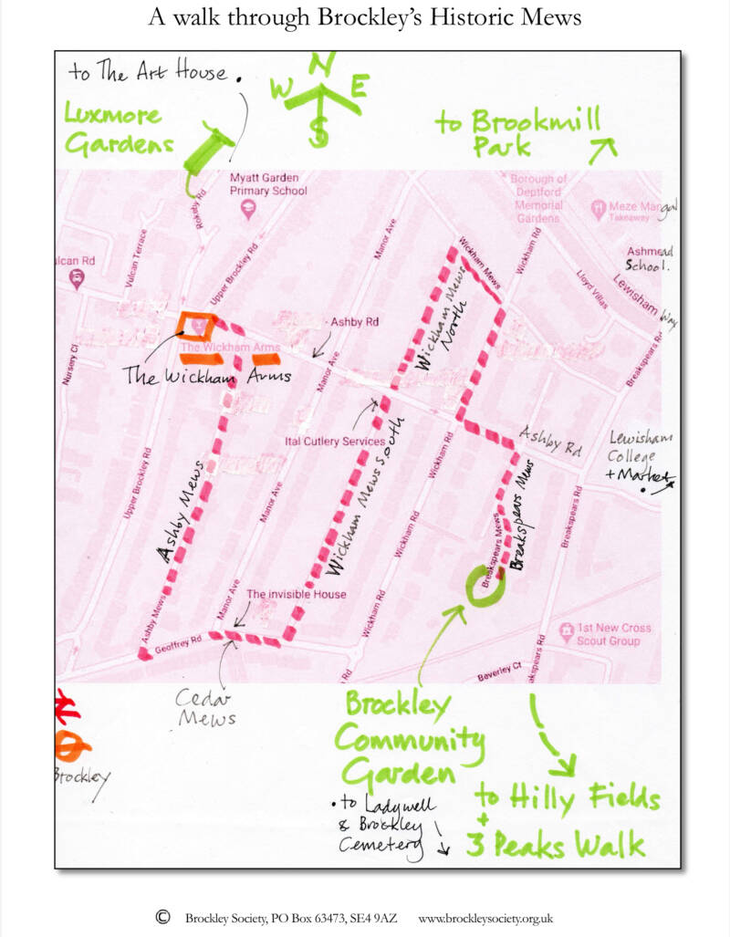
You are in Brockley
Vulcan
Vulcan (Latin: Vulcanus, in archaically retained spelling also Volcanus, both pronounced [wʊɫˈkaːnʊs]) is the god of fire[1]including the fire of volcanoes, deserts, metalworking and the forgein ancient Roman religion and myth. He is often depicted with a blacksmith's hammer.[2] The Vulcanalia was the annual festivalheld August 23 in his honor. His Greek counterpart is Hephaestus,
the section between Malpas Road and Upper Brockley Road is of interest. At the eastern end, on the south side, is a terrace of six small cottages of the 1860s. Just to the west of this terrace, Nursery Close leads to Milliners Court, an extensive and attractive development c1994. The major part of this is approached through a great gabled arch remaining from the garden centre which was formerly on the site; a small stream, now hidden in a culvert, runs through the site.
Opposite, Vulcan Terrace is a close to the north, mainly with postwar flats, but there are two cottages similar to those in Vulcan Road; also, the rear façade of Brockley Baptist Church (see below) and its former Sunday School (note the Gothic window) overlook the close.
Vesta
Vesta (Classical Latin: [ˈwɛs.ta]) is the virgin goddess of the hearth, home, and family in Roman religion. She was rarely depicted in human form, and was more often represented by the fire of her temple in the Forum Romanum. Entry to her temple was permitted only to her priestesses, the Vestal Virgins.
Welcome to HATCHAM
In the Domesday Book it is recorded as Hacheham. The name means "home of a man named Hæcci" and derives from an Old English personal name.[9] It is described as a manor containing land for three ploughs, nine villagers and two smallholders, 6 acres (24,000 m2) of meadowland and woodland for 3 pigs.
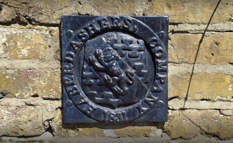
Hatcham formed part of the Brixton Hundred of Surrey in medieval times.[1] The manor was bought by the Haberdashers' Company in 1614, which later demolished the former manor house (during the 1840s) for redevelopment and the foundation of its schools.
GOLDSMITH COLLEGE

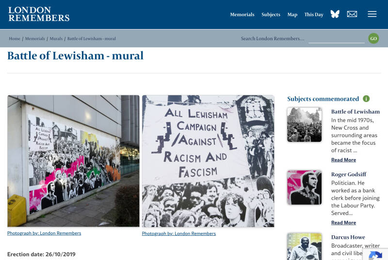
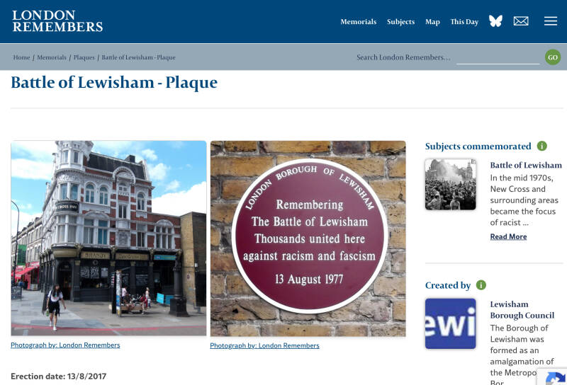
MURAL and PLAQUE: “The Battle of Lewisham”

THE MARQUIS OF GRANBY P.H.

Along New Cross Road
The LONDON ONE POSTCODE AT A TIME website covers the area magnificently

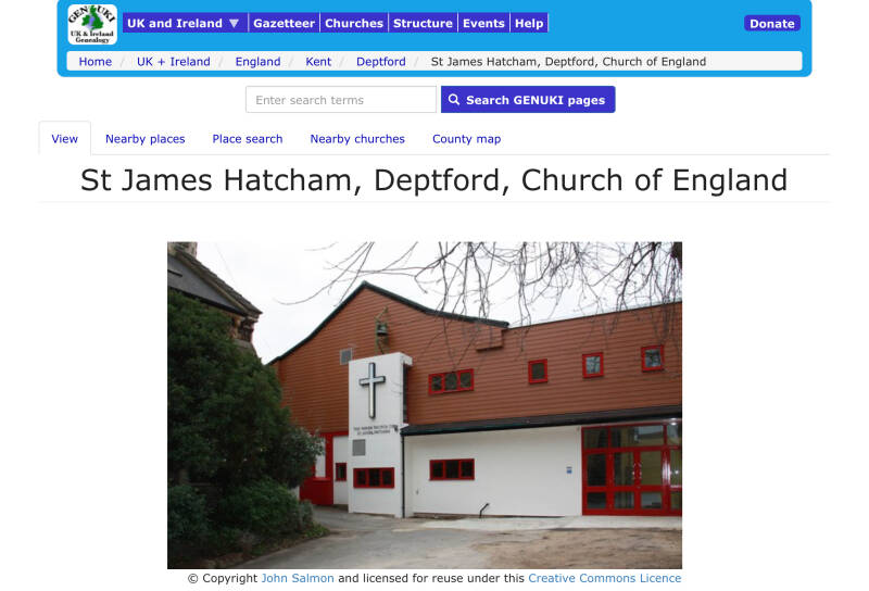
Former ST.JAMES’S HATCHAM Church

The church was designed by Walter L. Bozzi Granville, brother of the first Vicar; the design was shown at the Royal Academy in 1849, the foundation stone was laid on 18 June 1853 and the church was consecrated on 17 October 1854. The cost was £4,695. The north transept was altered by Arthur Tooth, whose architect was F. Rogers. A vestry was added in 1897 to the designs of W. Gilbee Scott.
It was converted for educational use by the Laban Centre for Movement and Dance in 1970.
Today the former church is a dedicated exhibition space available for all GOLDSMITH departments on campus.
Current Church
HABERDASHERS GIRLS’ SCHOOL

The Haberdashers (you will encounter the Haberdashers if you follow the route to Nunhead and Peckham)

In British English, a haberdasher is a business or person who sells small articles for sewing, dressmaking and knitting, such as buttons, ribbons, and zippers;[1] in the United States, the term refers instead to a men's clothing store that sells suits, shirts, neckties, men's dress shoes, and other items.
The word haberdasher appears in Chaucer's Canterbury Tales. It is derived from the Anglo-French word hapertas. It is debatable what hapertas meant, but most likely it was some type of fabric or assorted small ware. A haberdasher would retail small wares, the goods of the pedlar, while a mercer would specialize in "linens, silks, fustian, worstedpiece-goods and bedding". In Britain, haberdashery was originally a system for selling goods, and only later came to be used as the name for the types of goods sold under that system.P
In Continental Europe, Saint Nicholas remains their patron saint, while Saint Catherine was adopted by the Worshipful Company of Haberdashers in the City of London

EASTWARDS: Towards Deptford High St.
Plaque: THE NEW CROSS FIRE
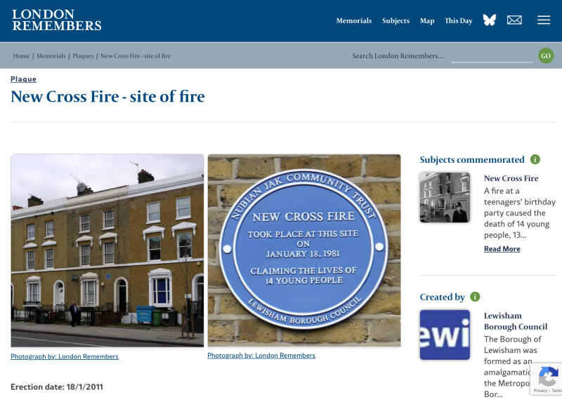
The New Cross fire, a tragic event that claimed 13 lives in January 1981, is often linked to the Brixton Uprising, a series of riots that erupted in April of the same year. The New Cross fire, a large house fire at a birthday party attended by many young Black British people, sparked outrage and fuelled existing tensions between the Black community and the police due to concerns of racism and inadequate police response. The community's anger and the lack of justice for the fire victims, coupled with widespread police discrimination and the "SUS" law, contributed to the eruption of the Brixton Uprising, a large-scale protest against racist policing.
Former DEPTFORD TOWN HALL

Former NEW CROSS BUILDING SOCIETY, now IYENGAR YOGA INSTITUTE

The New Cross (Equitable) Building Society was established in 1866 it did not move into this building (and presumably erect the shield) until about 1901. Prior to that the building seems to have been a private home, as it was for William George Fulcher when he died on 11th March 1887.
The building society used this building until 1984. By 1987 the Deptford Seventh Day Adventist Church had taken it over but they moved out in 1991. And in 1994 the yoga institute moved in.
New Cross Gate Railway and LO station
New Cross LO station (10 min. walk E)
FORDHAM PARK
FOLKSTONE GARDENS
DEPTFORD PARK
Rainsborough Rd
SURREY CANAL LINEAR PARK
GREENLAND DOCK
CANADA WATER
And on to NUNHEAD

Still along Vesta Road
The road was developed from 1878, and consists of short terraces, on the west side with fanciful capitals in the doorways and on the east side retaining Italianate features. At the beginning on the west side, note Crossway Court, three terraced blocks of flats of 1968, in a pleasing plain modernist style with nice balconies.
NEW CROSS CUTTING-BROCKLEY NATURE RESERVE
Brockley’s New Cross Gate Cutting (run by London Wildlife Trust, but not often open to the public) is predominantly oak woodland with open glades of neutral and acid grassland in which reeds and tall herbs grow. Some flowers are locally rare, and the site contributes to one of London’s most important railway cuttings for wildlife, stretching southwards to Forest Hill.
The cutting was dug in 1838-39 and still bears the legacy of once being part of the old Great North Wood

Railway bridge
The very wide railway bridge is a modern iron girder bridge with an iron parapet, though brick sections between pillars of an earlier parapet have been retained at either end. The bridge gives wonderful and dramatic views of the four tracks of the Croydon Railway (opened 1839) in deep cutting with steep wooded slopes, going north to New Cross Gate Station and south to Brockley Station.
Conservation Area

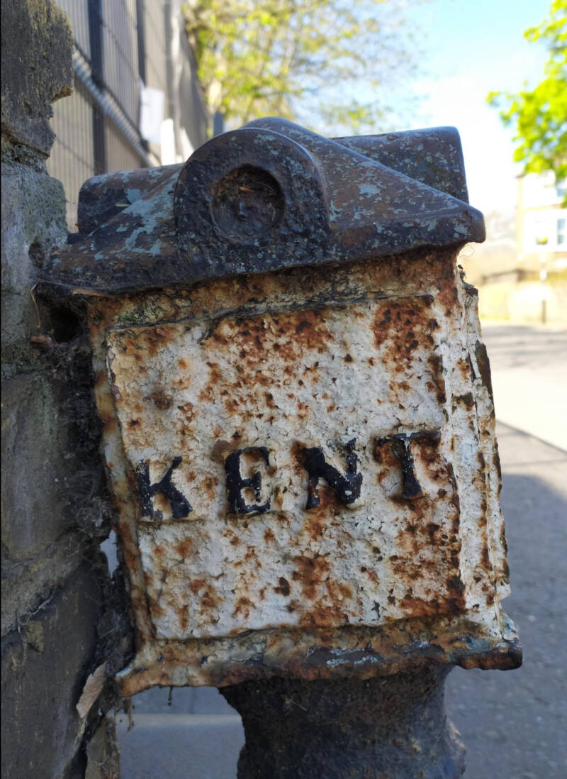
BOUNDARY MARKER - Former site of border between the counties of SURREY and KENT

HABERDASHERS HATCHAM COLLEGE

Formerly Haberdashers' Aske's Hatcham College is a state secondary school with academy status and a music specialism in New Cross, south-east London. The school was formerly a grammar school, then a comprehensive City Technology College and now an Academy operating between two sites near New Cross Gate.
In 2005 the Worshipful Company of Haberdashers established the Haberdashers' Aske's Academies Federation, which includes HAHC.
Originated in a bequest made by the merchant Robert Aske to the Worshipful Company of Haberdashers on his death in 1689, following which a school and almshouses were built at Hoxton near the city of London.
In September 2021 the school dropped the 'Aske's' from its title following controversy over the legacy of Robert Aske.
”Despite his philanthropic work, Aske’s life and work is not without some controversy. In 1672, he made an investment of £500 in the Royal African Company. This was a trading company which traded slaves from Africa to the West Indies between 1660 and 1708. The majority of investors came from the City of London business community, and included the Duke of York (later King James II). The history of the Slave Trade is painful and difficult to consider. It makes us question our assumptions about the past; answering these questions can deepen and enrich our understanding of our heritage.”
Former PUBLIC LIBRARY

Kitto Rd.
John Kitto (December 4, 1804 – November 25, 1854) was a self-taught biblical scholar of Cornish descent.
TELEPRAPH HILL (UPPER/LOWER)PARK
So what did they use before the electric telegraph? The answer to that question is related with the history of Telegraph Hill, in New Cross. Towards the end of the 18th century, experiments were carried out to send messages using a visual telegraph – from the top of one hill to another. The experiments led to a system – constructed by the Admiralty – to send signals along a line of hills and thus transmit information over very long distances. The process was ‘line of sight’ and was constructed across hills all spaced less than 10 miles apart.
The Shutter Telegraph was a huge wooden frame mounted on top of a building (sometimes built in brick but often just in wood). The frame supported six large wooden boards (called shutters) mounted in two vertical columns of three (see the drawing above). Each shutter was square with a side measuring about six to eight feet, operated by a man standing in the building below who moved it by a rope. The shutter could be moved from a horizontal position to a vertical position. From a distance, each shutter would become visible when moved to the vertical position and almost invisible when horizontal. The six shutters could transmit letters of the alphabet and numbers using a code.
Sadly, there is no evidence for either system on the hill today. The exact layout of the site on the top of this hill, which now a public park, is not even recorded which is a great pity.


NUNHEAD CEMETERY
Linden Grove (North) entrance

Detour to Brockley
Railway and LU station
BROCKLEY
5 miles (8 km) south-east of Charing Cross. It has been named the best area of London to live in. It is an area rich in Victorian and Edwardian domestic architecture, historic trees and original lanes and mews. This is protected by a conservation area and the Brockley Society. It has a strong community and numerous popular cafes and restaurants. The station is on both the mainline railway and the LO Windrush Line.

Limesford Road entrance
NUNHEAD
Evelina Road and Nunhead Green
Shops and eateries
PECKHAM