GREENWICH PARK to BLACKHEATH VILLAGE and LEWISHAM
SOUTHWARDS! The route from BLACKHEATH can continue on S, towards MANOR HOUSE GARDENS, MANOR PARK, ST.MARY THE VIRGIN church and LADYWELL. Possible de tour to HITHER GREEN
GREENWICH PARK
After Blackheath Avenue and exiting through the Gate, Duke Humphrie’s Rod


Exiting the Royal park: along the GRAND AXIS
The "Blackheath Grand Axis" refers to a line of sight connecting Greenwich Park to the spire of All Saints Church in Blackheath, a major formal axis of the World Heritage Site in Greenwich. This axis is designed to create a visual link from the River Thames, through the Queen's House, and to Blackheath. This historic view is a key feature of the area's urban planning and landscape, intended to create a dramatic and continuous vista across the Greenwich peninsula.
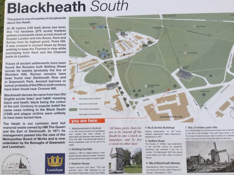
Blackheath
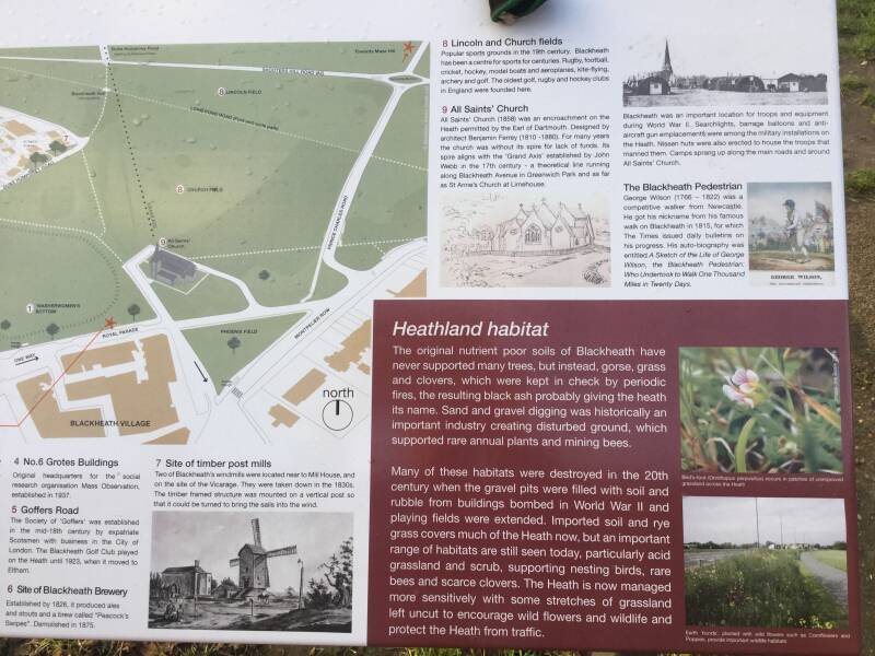
Lying on the plateau above Greenwich, 125 ft hight.. 267 acres of grassland rolling towards the village.
The origin of the name refers to it soil, or perhaps the bushes that covered it, which were dark in appearance. Not because it was a burial site for the victims of the BLACK DEATH of the 1340s. It may have looked black…and barren. Treeless, empty…
A scene of momentous moments in English history. Along the road that bisects the open space, marched the Roman legions on their way to future LONDINIUM. The road would become WATLING STREET, the main road to DOVER.
An assembly point…for invaders and dissenters. The DANES may have camped here in 1011, before murdering ALFEGE, Arch. of Canterbury.
The PESANTS’ REVOLT: WAT TYLER and his supporters, protesting against the POLL TAX, gathered here to meet RICHARD II, in 1381. JOHN BULL gave a rousing, revolutionary sermon (when Adam delved, and Eve span…). In 1450, the rebellious followers of JACK CADE bivouacked here, before entering London with the BLACKHEATH PETITION to air their grievances. CADE was slain and his men returned to the heath “naked save their shirts” to beg the king’s pardon for their outrages.
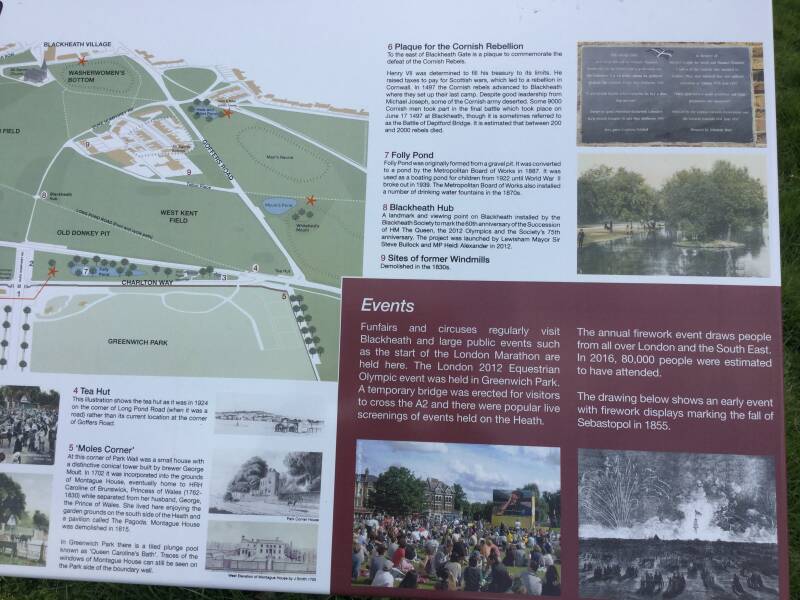
In 1497, 6.000 Cornishmen fought a pitched battle here against the imposition of another tax, by HVII. Some 2.000 were slain.
An official welcome awaited RII and ISABELLE, his Fr.bride, in 1400. In 1415, a jubilant crowd greeted HV on his return from AGINCOURT.
Tents and pavilions were erected for the feast arranged by HVIII for the arrival of ANNE/CL. (he got disappointed), in 1540. And in 1660, the LM of Ldn and dignitaries waited here to escort CHIÍ to London, at the RESTORATION.
This used to be a dangerous, forbidding place… Highwaymen and footpads were common place during thec18th c. when gorse and scrub covered it.
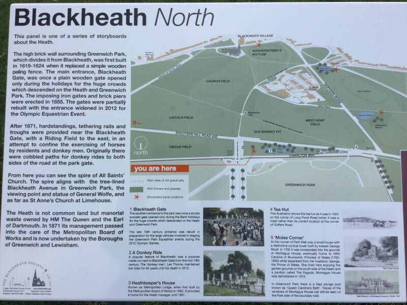
One of the trivial myths of Blackheath's history is that it is common land.
In fact the heath is manorial waste, mostly of the Earl of Dartmouth's Manor of Lewisham and also the Royal Manor of Greenwich. The freeholders gave free use to Londoners in 1871.
The heath's chief natural resource is gravel, as well as chalk a limestone, and the freeholders retained rights over their extraction. That gravel digging left permanent scars of pits and ravines. Under POINT HILL several large caves were discovered in 1780. They were most likely the result of chalk workings. During the 19th c. torchlight visits, parties and a masked ball were held there. Today however, they are sealed, as they are unsafe.
“Goff”and other sports
It may have been played here in JI’S reign. Did he taught the English to play GOFF while in residence?. The ROYAL BG CLUB is said to be the evolution of a club -the FIRST ever-founded here.
CRICKET was played here Early 19th c. In 1858 was formed here the BRF CLUB, and it attracted so many supporters that it had to move to RECTORY FIEKDS (CHARLTON RD), its current base,
BLACKHEATH VILLAGE
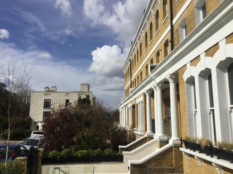
Its triangular shape is characteristic. The place were the roads from LEE and LEVISHAM met to cross the KID BROOK (and divide their courses again). Some cottages and an inn were the only buildings, in the M.A. It became a fashionable suburb for wealthy London merchants. First, when the Earl of Dartmouth, Lord of the Lewisham Manor built DARTMOUTH ROW.
This is reflected in many of the fine buildings found here today, built in the 18th c. by speculators along the S. of the Heath, and later on the Eastern side. In order to service the wealthy houses the village came gradually into existence, where traders moved into to service them.
Train station and more developments followed.
ALL SAINTS CHURCH
Built on the heath in 1857, despite much protests from a few of the locals
What is now the centre of the village, where the roads joint to cross the KID BROOK,was known as BLOUNT’S HOLE (after the residents of the WINKLEMARSH ESTATE) and, later, the DOWAGER BOTTOM, during the time LADY SUSANNAH MORDEN’s lon widowhood.
No village was in place when J.ROCQUE surveyed the S of the heaths, in the 1740s. He marked 6 buildings at the DOWAGER’S BOTTOM. THE CROWN and a few cottages (now part of COLLINS SQ.
Within 60 years a village had consolidated with more than 100 traders and small businesses, into a triangle with two converging sides: TRANQUIL VALE and MONTPELLIER VALE. The ROYAL PARADE would be b. Overlooking the heath, as the base of the triangle.
Blackheath Railway station
Opened in 1849, the arrival of the railway helped consolidate the building area, and end the rural peace. It was designed by GEORGE SMITH, of BROOCKLANDS HOUSE (ST.MICHAEL & ALL SAINTS).
It is one of the few ORIGINAL stations still left operating in London. From London, the line made its way through a natural valley. Then went on to WOOLWICH and GRAVESEND. A tunnel takes the trains under MORDEN COLLEGE and deep cuttings were made, so little disturbance was made in the landscape, and only 5 houses were pulled down on the extension to CHARLTON. They were were conscious or sensitive to the scenery, those days!. And, in the village, only the low rumble and the engine smoke above the bridge at the bottom of the VALES made Blackheath aware that there was a train… OMNIBUSES and CABS started to run from the station.
Growlers started to line up TRANQUIL VALE. From the Southern end of LEE ROAD, THOMAS TILLING BUSES served the route to ELTHAM (1867-1907). The largest transport company. Large depots , for stabling, were opened… in the 20th c., motor buses (the last horse us ran in 1912)
From a sleepy village, residence for the carriage classes… to an ideal place to live for the middle classes. 20 minutes away from Central London. The population spread over the CATO ESTATE and South of BELMONT HILL.

Greenwich Park, West Grove, Blackeath (Dartmouth Estate) and on to Lewisham
Exiting the Park via gate beside RANGER’S HOUSE
Cade Road
West Grove

Astronomer JAMES GLAISHER lived here

CHURCH OF THE ASCENSION

“The Church of the Ascension is a place for everyone: young or old, male, female or non-binary, straight or LGBT+, believers, doubters, those who are seeking, those who are lost and those who are found. We seek to serve God, to care for our world and to love our neighbour. We fall short, because we are human, but we trust in the redeeming love of our Saviour. Come as you are, for you are welcome at the table of Jesus. All are welcome in this place.”
Pre-1753, two storeys , basement and attic house, in brown brick with a stone coped parapet. Five bays. The roof is a mansard with slates and square dormers with sashes. The projecting central section of the facade has brick quoins. The windows have gauged brick flat arches with recessed sashes in stuccoed reveals. The central window at first-floor level, above the main door, has a moulded stone architrave with triple keystone. There is a Gibbs surround to the doorway which also has heavy keystones. The door itself has two flat panels and four fielded ones with a plain fanlight above.
Morden Hill
Site of ST.JOHN’S HOSPITAL
Elverson Road DLR station

Following the course of the RIVER RAVENSBOURNE: the WATERLINKS WAY

Thrurston Road
RETAIL PARK
CORNMILL GARDENS
Moleslesworth Road
SHOPPING CENTRE
High Street
LEWISHAM MARKET

Northwards: From BLACKHEATH village to ELVERSON ROAD Station
THE HARE AND BILLET P.H.
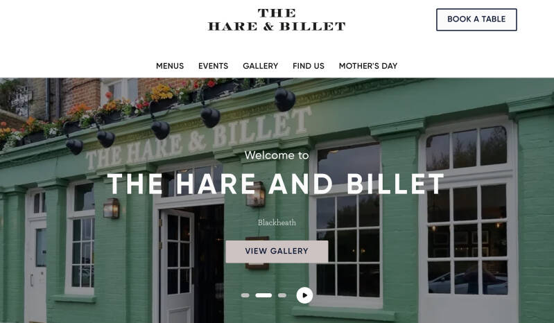
Dating back to the 18th century when it was a coaching inn serving travellers on the London to Dover road. Watling Street, the Roman road to Dover, crossed the bleak and forbidding Blackheath and, in the 18th century, this stretch of the busy route was notorious for its highwaymen. At this time, the Hare and Billet was an isolated coaching inn on the heath.[3] The establishment has been trading since the 1600s.
The pub gained notoriety in 2014 when an MP mistakenly named a condiment served there as a "parasitic copy," leading to a backlash nicknamed "Hendogate".
Today, it's a modern pub with a rustic feel, known for its ale and food focus, dog-friendly atmosphere, and proximity to Blackheath
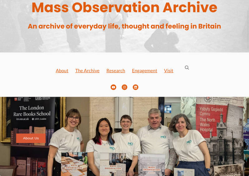
MASS-OBSERVATION
Mass-Observation is a United Kingdom social research project; originally the name of an organisation which ran from 1937 to the mid-1960s, and was revived in 1981 at the University of Sussex
Polar explorer SIR JAMES CLARK ROSS lived here

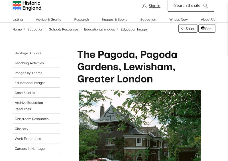
THE PAGODA (house)

Heading S.: After BLACKHEATH railway station

Cresswell Park
Site of the ALEXANDRA ASSEMBLY ROOMS
Taking its name from PRINCESS ALEXANDRA of DENMARK, recently engaged to EDWARD, the PRINCE OF WALES. Opened in 1863, it was the first institution that catheter for the residents cultural needs. A reading room in Grecian style, where, by day, courses on Italian language, harp, philosophy and callisthenics were available “for the daughters of Gentlemen only”. And where concerts were held at night
Church of OUR LADY HELP OF CHRISTIANS (or ST.MARY’s, for the locals)
The Church of Our Lady Help of Christians was built in 1891 and was consecrated in 1906. It is a good example of Victorian Gothic style and is a Grade Two listed building. It was extensively renovated in 1999 with the help of a major grant from English Heritage.
THE CONSERVATOIRE
The Conservatoire of Music and the Arts took on its current structure in 1991 with the merger of the Blackheath Conservatoire of Music and the Blackheath School of Art, which until that point had operated separately on the adjoining sites, but under the same board.
Both the Conservatoire of Music building and School of Art building were completed in 1896. The architects were James Edmeston and Edward Gabriel. Both buildings are now Grade II-listed.
It is believed to be the oldest purpose built multi-arts building in London and one of the few to have a fully operational Victorian life drawing studio
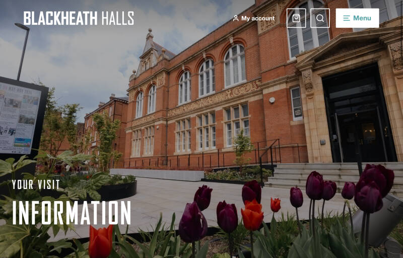
BLACKHEATH HALLS
Lee Park (road)
LOCK CHASE housing development
A post-war development of houses and maisonettes, primarily built in the 1950s. It is located on a quiet street off Lee Park in the Blackheath Conservation Area, close to Blackheath's village center, station, and the heath itself. The development is known for its rich architectural legacy and strong horizontal emphasis, with the flats featuring an expressed reinforced concrete frame
Site of CHRISTCHURCH
Welcome to Lee

Old Road
WALL: Site of LEE PLACE
LEE PARK NURSERY
LEE CENTRE
MANOR HOUSE LIBRARY
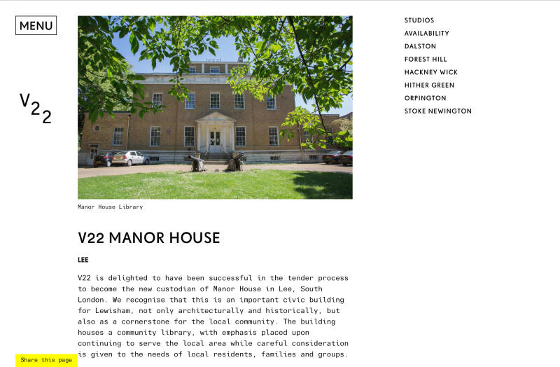
At an auction at Garraway’s Coffee House, in the City in 1796, Francis Baring, banker and chairman of the East India Company (whose family business activities had originated, as had two previous owners, with the West Country woollen trade) paid £20,000 for 623 acres, including the Manor House of Lee. Baring was one of the most influential men of the age, described by the Prime Minister of the day as ‘a merchant of great character and responsibility’. Francis Baring used the house as a rural retreat to his business and political activities in the city.
MANOR PARK GARDENS

After enjoying the Gardens… Alternative route to MANOR PARK, along Manor Lane and Northbrook Rd
LOCHABER HALL Community Centre
built in 1910 as the church hall for Holy Trinity in Glenton Road – quarter of a mile away on the other side of Lee High Road. The Hall was built on some of the last bits of farming in the area – Manor Nursery, the nursery had been built as kitchen gardens around 1800 by the then owner of the Manor House, Sir Francis Baring, its collection of fruit trees was described in 1882 as ‘one of the best on this side of London’. Some of its boundary walls predate its current usage.
Regular route through MANOR PARK GARDENS
RIVER QUAGGY
The River Quaggy (often the Quaggy River or simply Quaggy) is a river, 17 kilometres (11 mi) in length, passing through the south-east London boroughs of Bromley, Greenwich and Lewisham. In its lower reaches it is an urban river, in its upper reaches further from London it is more natural and known as the Kyd Brook. The river rises from two sources near Princess Royal University Hospital (PRUH) at Locksbottom and is a tributary of the River Ravensbourne which it flows into near Lewisham station in Lewisham.
On exiting the gardens
Hither Green railway station (100 m)
Detour to HITHER GREEN and CATFORD, returning along LADYWELL FIELDS
Manor Park (street)
MANOR PARK
Dermody Gardens
Romborough Way
Cross over Lewisham High St.


Nearby
LEWISHAM HOSPITAL
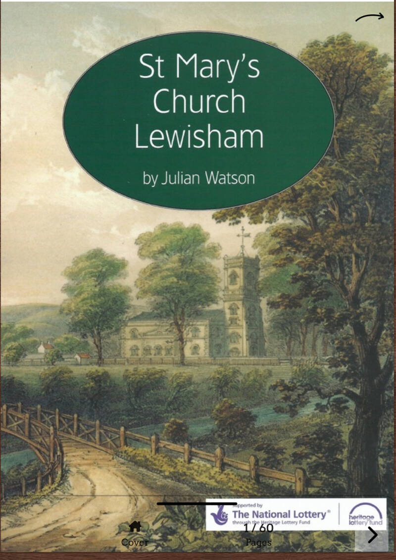
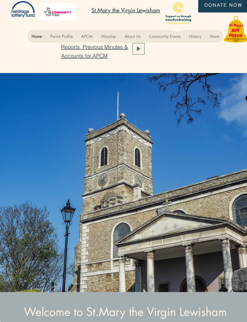
ST.MARY THE VIRGIN, parish church
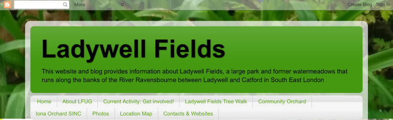
LADYWELL FIELDS
As Ladywell began to develop as a suburb of London with the arrival of the railway station in 1857, in 1889 land between the River Ravensbourne and the station was bought by London County Counciland Lewisham District Board of Works. Further parcels of land were bought in 1891 and ’94 and the whole area was laid out as a public amenity and named Ladywell Recreation Ground.[1] According to author and historian Nick Barratt, Ladywell Recreation Ground was purchased for the parish in 1889.
RIVER RAVENSBOURNE
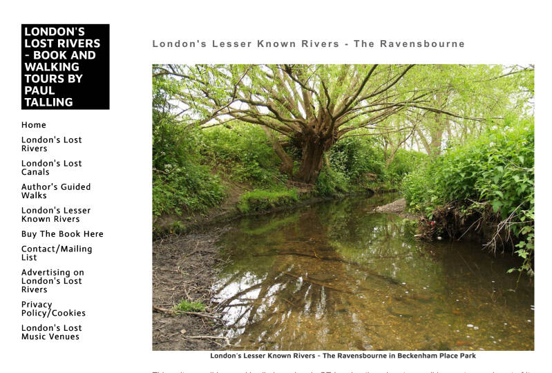

The Ravensbourne at Ladywell Fields formerly ran along the edge of the park hidden behind railings and dense vegetation. As a result it had become largely unnoticed. The river was then diverted in 2008 to meander through the park
Ladywell railway station

Shops and eateries

Site of the 15th c. well

The site of the ancient well is difficult to locate precisely today as it was under the present Ladywell Bridge close to the junction of Railway Terrace and Ladywell Road — almost in the middle of the road! Henry Warren said in 1827: "Many resort here to drink the waters, the properties of which resemble those of Cheltenharm."
Nearby
ST.MARY’s Church Hall
Former PUBLIC BATHS
Former CORONER’S court
Former POLICE STATION
This particular building was designed by John Dixon Butler (1861–1920) and completed in 1903. A collaborator of Norman Shaw, as Surveyor and Architect to the Metropolitan Police he designed over 200 public buildings.
Former FIRE STATION
Algernon Rd.
Marsala Rd.
PRENDERGAST VALE COLLEGE
CORNMILL GARDENS, RIVER RAVENSBOURNE
THE GLASS MILL, LEISURE CENTRE
Lewisham Town centre

Railway station

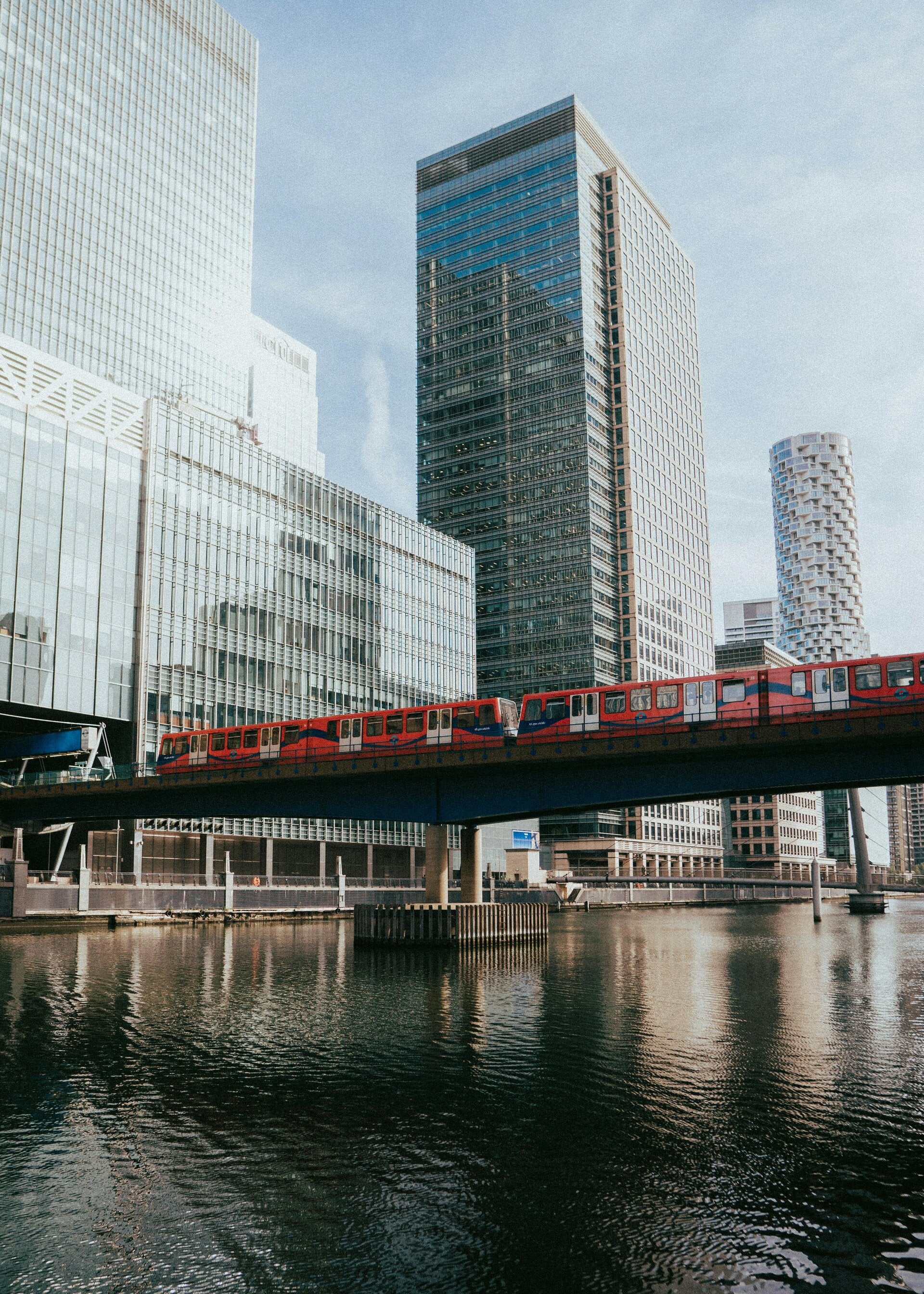
DLR station