From THAMES BARRIER to ELTHAM
MARYON & MARYON WILSON PARKS
CHARLTON CEMETERY & CHARLTON HOUSE
KIDBROOKE VILLAGE and KIDBROOKE district
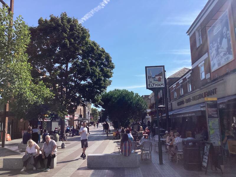
ELTHAM
MARYON PARK and MARYON WILSON PARK
Both Maryon Park and Maryon Wilson Park are part of the former estate of the Maryon Wilson family, who presented it to the public in 1890. Maryon Park and Gilbert’s Pit are former sandpits, the source of sand used as floor covering in the days before carpets became common. They are both separate from Maryon Wilson Park, which lies to the south. There is an animal park in Maryon Wilson Park, home to ducks, geese, chickens, a pig and deer. The railway passes through the northern edge of the site via a couple of railway tunnels. A path leads steeply up from near the level crossing in Charlton Lane to pass above the western tunnel and provides fine views from the top. A path branches off part way up into Gilbert’s Pit, a Geological Site of Special Scientific Interest. This extremely valuable geological site reveals a sequence of sediments dating from approximately 55 million years ago (the Lower Tertiary Sequence), with an information board providing details near the base of the cliff. Maryon Wilson Park and Gilbert’s Pit were declared a Local Nature Reserve in 2005. There are free tours of the animal enclosures at Maryon Wilson Park available. Both parks are freely accessible, and the Green Chain and Capital Ring walks pass through the site.
The MARYON WILSON family in HAMPSTEAD
The Maryon Wilson family were the Lord of the Manor of Hampstead and owned much of Hampstead Heath in the 19th century, with Sir Thomas Maryon Wilson (died 1869) being the one most associated with it. As he inherited the land from his father he aimed to build a grand estate with 28 villas on it Residents successfully fought his plans, resulting in an Act of Parliament in 1871 that protected 200 acres of the Heath for public use. The family's legacy there is an ornamental viaduct on the Heath, also known as "Wilson's Folly," which is a reminder of their controversial plans and the subsequent preservation efforts
VISIT HAMPSTEAD HEATH!: https://www.heathandhampstead.org.uk/heath/
CHARLTON CEMETERY
CHARLTON PARK
HORNFAIR PARK
CHARLTON LIDO
PETS CEMETERY
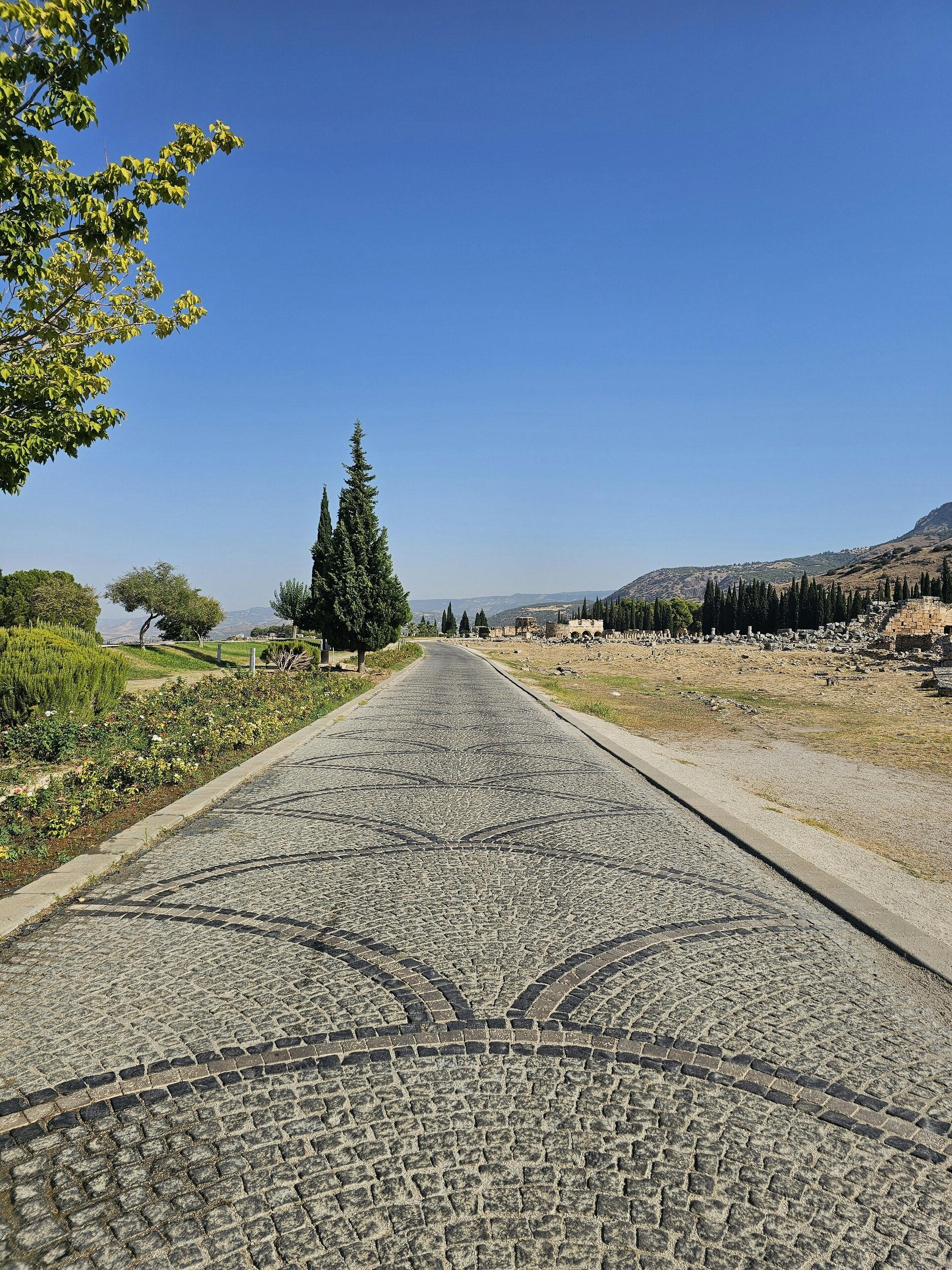
Shooters Hill
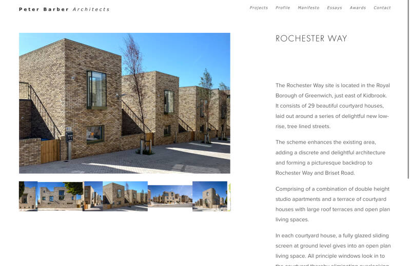
Rochester Way
The A2 is a major road in south-east England, connecting London with the English Channel port of Dover in Kent. This route has always been of importance as a connection between London and sea trade routes to Continental Europe. It was originally known as the Dover Road.[1] The M2 motorway has replaced part of the A2 as the strategic route.
The route of the current A2 follows a similar route to that of a Celtic ancient trackway. It was an important route for the Romans linking London with Canterbury and the three Channel ports of Rutupiae (now Richborough), Dubris (now Dover) and Portus Lemanis (in modern Lympne). It had river crossings at Rochester over the River Medway; Dartford (River Darent) and Crayford (River Cray). The Romans paved the road and constructed the first Rochester Bridgeacross the Medway. Access to London was via London Bridge which was first constructed by the Romans in AD 50. The road appeared in the Antonine Itinerary, a contemporary map of Roman roads in Britain, as 'Item a Londinio ad portum Dubris'.
In Anglo-Saxon times it became part of a longer road known as Wæcelinga Stræt ('Watling Street' in modern English).
The area in 1937, before ROCHESTER WAY was laid out
KIDBROOKE
Derived from an Anglo-Saxon name meaning 'the brook where the kites were seen,' indicates that the area was uninhabited at the time of naming. With its three streams and heavy, wet clay, Kidbrooke would have been unsuitable for Saxon settlement.
However, by the late 11th or 12th century, Kidbrooke had established a church and likely had a small population, although this presence didn't endure. By 1428, the church lacked a priest, and by 1494, it had fallen into disrepair.
Remaining rural until the inauguration of Kidbrooke railway station in 1895, the region was primarily dedicated to farming until the 1930s.
Rochester Way
ROCHESTER WAY new development
KIDBROOKE VILLAGE
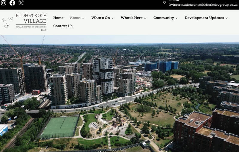
The original 1960s Ferrier Estate became a "sink estate" and was marked for redevelopment in 2001. The site is now a large-scale regeneration project, Kidbrooke Village, which includes new council homes built by the Royal Borough of Greenwich and private/affordable homes by developers like Berkeley Homes and L&Q
THE BALLOON P.H., a YOUNG’S PUB

Site of RAF station
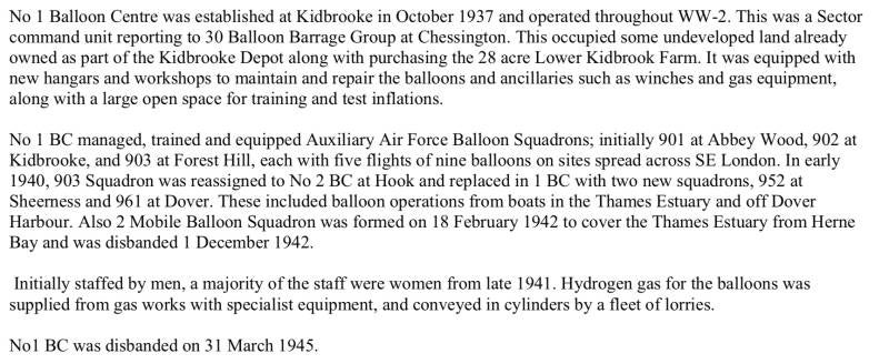
Royal Air Force Kidbrooke or more simply RAF Kidbrooke is a former Royal Air Force station, situated in Kidbrooke in south-east London, in the Royal Borough of Greenwich. The site was operational from 1917 to 1965 and was mainly used as a stores, maintenance and training facility.
A very important unit based at Kidbrooke was No 2 Installation Unit. From 1939, this was responsible for constructing, maintaining and repairing all of the Chain Home radar station masts around the UK coasts throughout WW-2. The standard CH station layout had four steel 360 ft transmitting pylons (some later ones in the West had 360 ft guyed steel masts) with four 240 ft guyed wooden receiving masts. The Unit moved to West Drayton in 1945. The last Chain Home radar station closed in 1955.
https://en.wikipedia.org/wiki/Chain_Home
https://www.bbc.co.uk/history/ww2peopleswar/stories/91/a2137691.shtml
An RAF Technical & Wireless School was at Kidbrooke from the 1920's. As well as its instructional work, this had an important R&D role. In recent years, the story of the work at Bletchley Park to decrypt the German Enigma communication system has been widely publicised. This opens the question of what were the Allies doing to protect their own messages? Both the British (initially at Kidbrooke) and the Americans had separately developed their own versions of Enigma!
Site of the infamous FARRIER ESTATE
SUTCLIFFE PARK
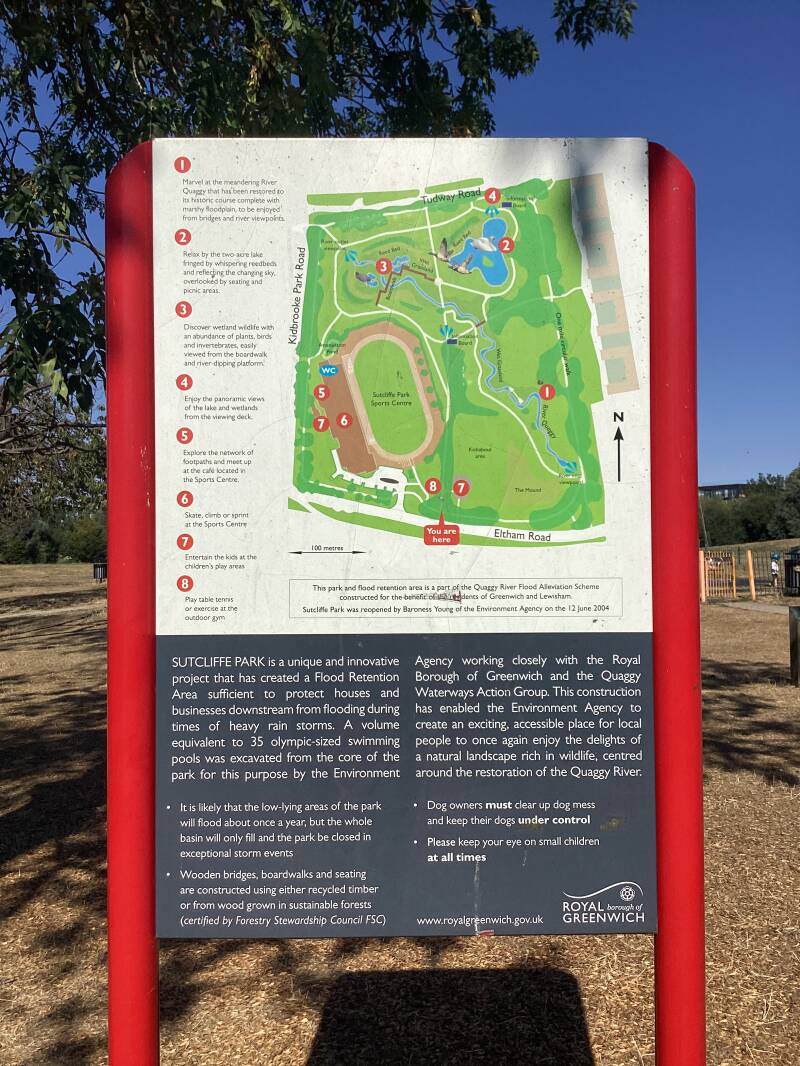

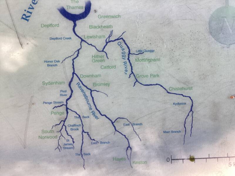
The site was formerly known as Harrow Meadow. It was prone to flooding, and in the 1930s, when the surrounding area was being developed for housing, Woolwich Metropolitan Borough Council culverted the River Quaggy and laid out the site as playing fields. It was opened as a park in 1937, named after a former borough engineer. The area around the park still suffered from flooding, and in the 1990s the ground level was lowered in part of the park to hold flood waters, while the river was restored to meander at ground level. The scheme also including re-landscaping of the park to emphasise biodiversity and ecological benefits, with wetland areas and a lake. The park was re-opened in 2004,[7] and the central area of the park, around the flood water collection area was declared a local nature reserve in 2006.
PROGRESS ESTATE (both sides of WELL HALL ROAD)
Well Hall Road
ELTHAM